
Lofoten: hiking beyond the Arctic Circle
midnight sun hiking and discovery trip
We arrived at the islands by ferry from the Nordic city of Bodø, where the airport is located, and began our tour in a vehicle driven by our guide, traveling from island to island and exploring the most beautiful routes on foot. We stayed in comfortable fishermen's cottages called Rorbuer and in some hostels. We traveled the islands from south to north and from west to east, marveling at the landscapes between sea and mountains, charming fishing villages, and almost untouched nature.
We end this journey in the small town of Evenes, but those who wish can continue for 5 more days towards Rago National Park and its magnificent lakes and waterfalls and Sjunkhatten National Park, before returning home from Bodo.
10 days from €2,250
Dates: July 3-12 (possible extension until July 17, exploring Rago National Park and Sjunkhatten)
Difficulty: 2-3/5 hiking/trek
The pluses of this program
Hiking and trekking in the Lofoten Islands
Small group to further integrate ourselves into nature.
Some nights in a tent in the middle of nature
Two ferry journeys
The midnight sun, we traveled during the weeks of the summer solstice.
.
PROGRAM
Day 1 · Flight to Bodo, Norway.
Arrival at Bodo airport. Overnight stay in a hostel in Bodo.
Day 2 · Ferry to Moskenes (Lofoten) and ascent to the summit of Tindstinden
Early morning ferry from Bodø to Moskenes in southern Lofoten. There, we begin our hike to Sørvågen. Upon reaching Lake Stuvdalsvatnet, we turn off towards the hillside overlooking the lake, which offers a magnificent view of the ocean. We continue to a small pass before reaching the summit of Tindstinden (490 m), from where we can see Sørvågen on one side and the small village of Å on the other. From the summit, we enjoy a splendid view of the fishing village of Å and its lake.
Ferry time: 3 hours
Walking time: 4h
Elevation difference: 500m +/-
Days 3, 4, 5, 6, 7. Some of the most beautiful hiking trails in Norway, the most beautiful village in the country (according to Norwegians), seabirds, fjords, peaks,….
Here are some of the possible routes we will take during these days as we travel from island to island in our vehicle, heading north.
Sørvågen: Munkebu mountain hut (410 m) - optional summit of Munkan (775 m)
Elevation gain: 600 m to 900 m. Elevation gain: 600 m to 900 m. Hiking time: 5 hours 30 minutes to 7 hours 15 minutes.
Ascent to the small mountain refuge of Munkebu, situated at an altitude of 410 meters in a high-altitude environment, amidst lakes and craggy peaks. The trail offers views of a series of deep lakes. It is possible to continue to the slopes of Munkan, which rises to 775 meters. Glacial erosion has sculpted deep gorges in the ancient Hercynian rock, dominated by slender peaks.
Sørvågen: Reinebringen summit (484 m)
Elevation gain: 480 m. Elevation loss: 480 m. 4 hours of hiking.
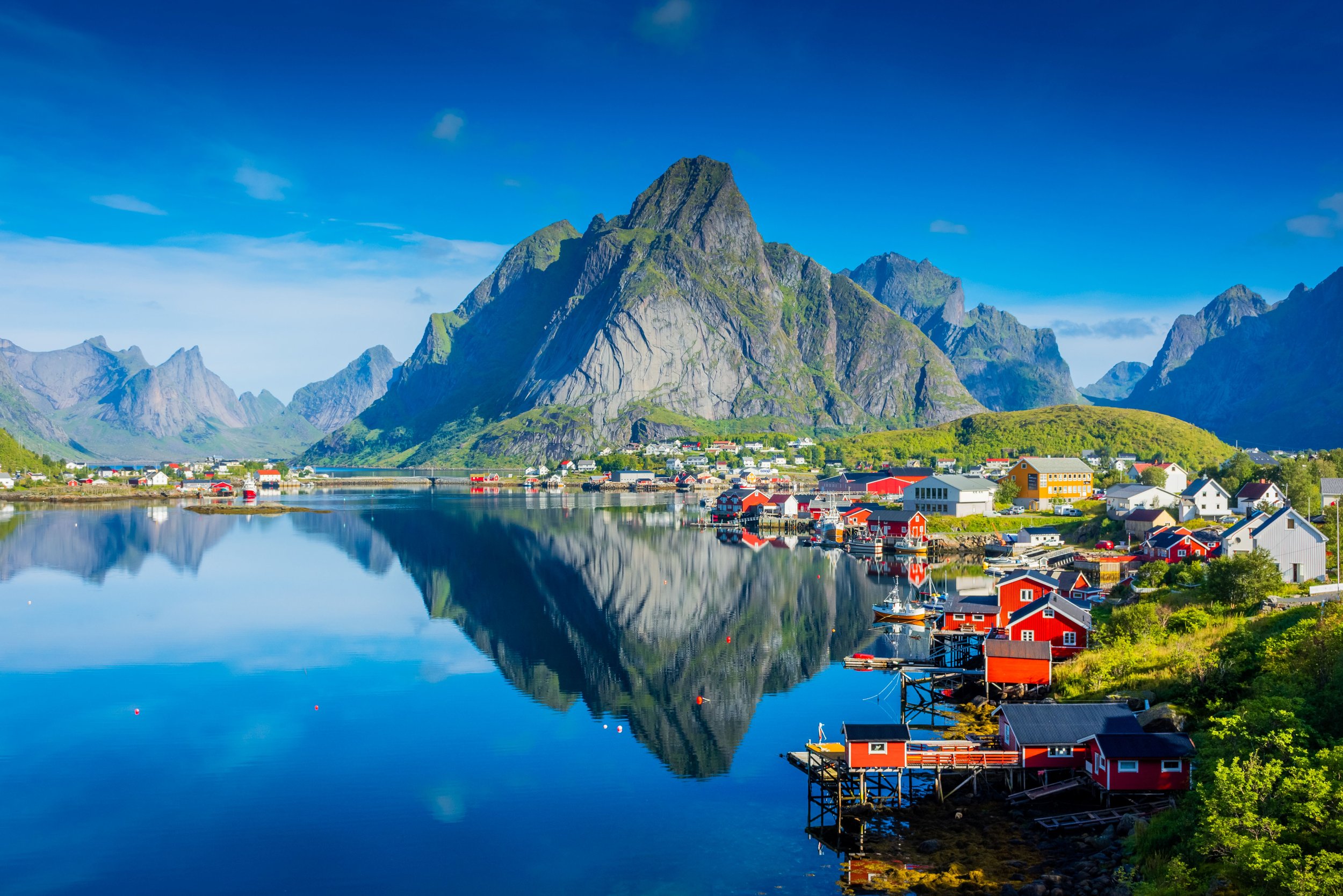
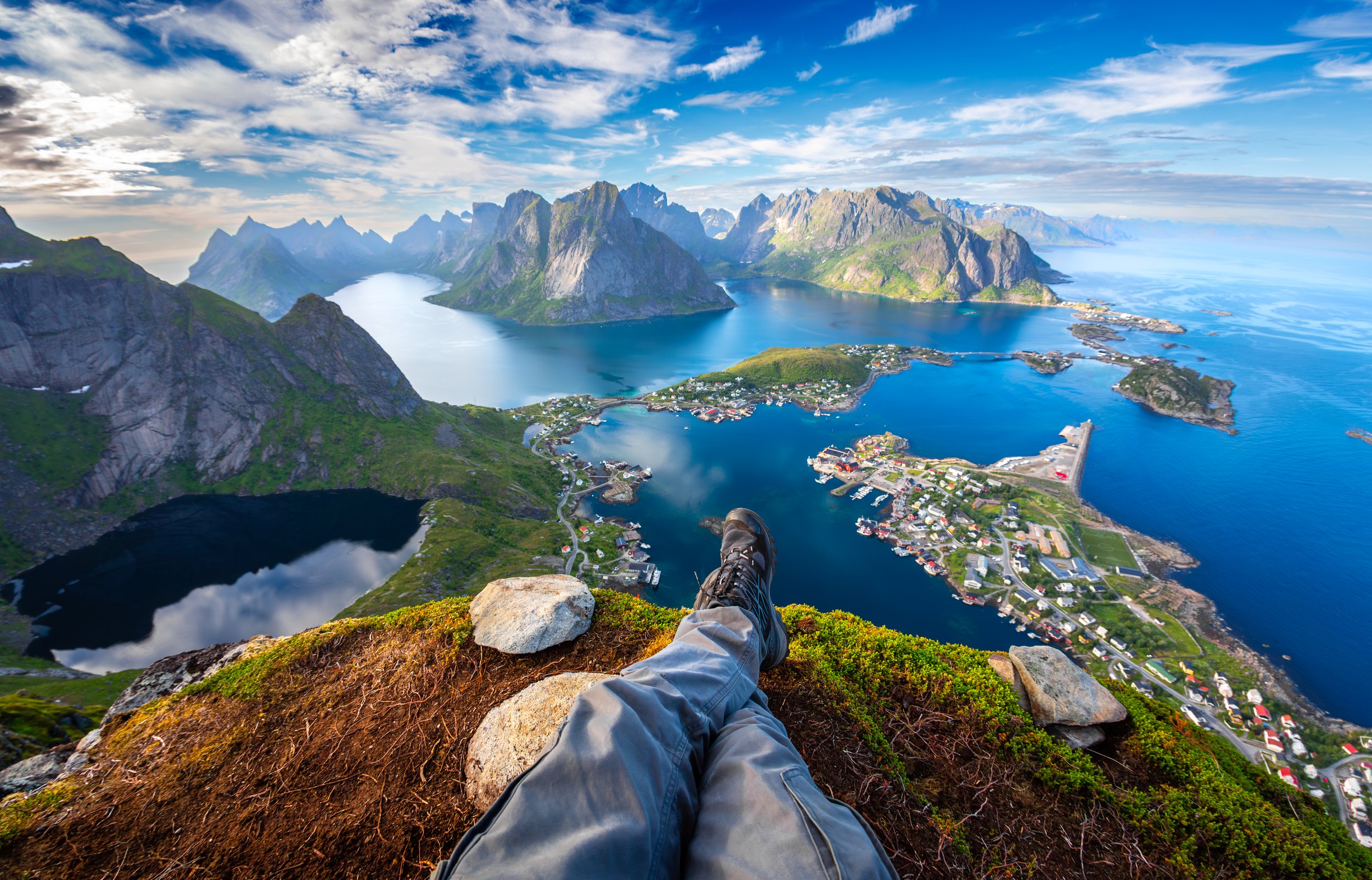
Transfer to Reine, a village where the sea divides into several fjords with almost vertical walls, and which Norwegians have voted the most beautiful village in Norway. From the village, ascend to the summit overlooking it: Reinebringen. The 1,664 steep steps clinging to the mountainside lead to the summit ridge and an incredible panoramic view of the Westfjords and the fishing villages of Reine and Hamnøy. The sight of the jagged peaks of Mount Floan plunging into the turquoise waters of the fjord is breathtaking. Return to the village via the same route and transfer to Fredvang.
Ryten (543 m) and Kvalvika Beach
Elevation gain: 700 m. Elevation loss: 700 m. 5 hours of hiking.
From fjords to lakes, passing through Ryten (543 m), and then Kvalvika and its beautiful golden sand beaches, which, beneath these rugged mountains, evoke the Marquesas Islands, so beloved by Brel. An emerald sea with fishing nets beached and abandoned by the sea, Siberian driftwood, and other less exotic relics of our civilization.
Nusfjord - Tønsåsheia (769 m) - Ballstad
Elevation gain: 850 m. Elevation loss: 850 m. 5.5 hours of hiking.
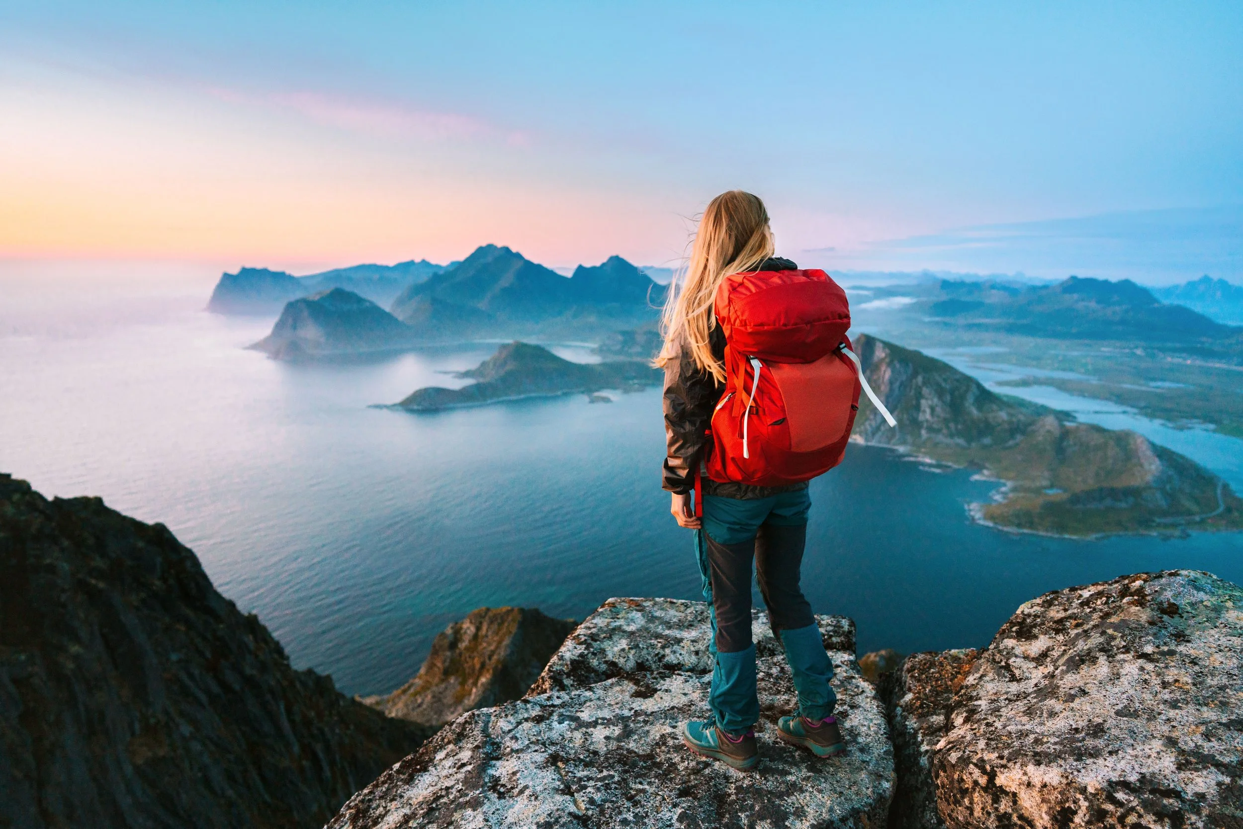
Transfer to the open-air museum village of Nusfjord, one of Norway's oldest fishing villages, with its colorful rorbu cabins. A beautiful and steep hike above Nusfjord, with a very short section that will require our full attention. Breathtaking views of the entire southern archipelago from Tønsåsheia, the summit of Mosestind. Mosestind can be translated as "moss mountain" or "Moses mountain," the botanical origin being the most likely.
We explored Nusfjord and moved on to Ballstad, a lively town and port: a shipyard decorated by a painter and a renowned cod liver oil factory (tran). We've crossed to another island: we're now on Vestvågøy (after the islands of Moskenesøya and Flakstad).
Nonstind (459 m) and Munkan (494 m)
Ascent: 600 m. Descent: 600 m. 6 hours of hiking.
Ascent to the Ballstadheia plateau, an Arctic meadow where a few sheep graze. Beautiful view of the reef garden, the English term for a sea dotted with sharp rocks, a death trap for the distracted or inexperienced sailor. These gardens abound along the Norwegian coast. Norwegians call them skjær, pronounced "char." From there, the beautiful panoramas of the archipelago continue. Pass by Nonstind, "the nun" (425 m), and Munkan, "the monk" (459 m). Steep descent back to Grenvika Bay and a narrow, balcony-like path along Torlan Bay.
During these days we will combine camping with some nights in a Rorbur or fisherman's cabin converted into comfortable accommodation.
Day 8 · Excursion to Breidstinden (449 m) - Sildpollnes Peninsula
Elevation gain: 600 m. Elevation loss: 600 m. 5 hours of hiking.
A varied hike from Ballstad to the Kyllingdalen Valley. The trail winds around several lakes reminiscent of Ireland, through a fragrant young coniferous forest with a Scandinavian feel, and leads to the summit of Breidstinden at the end of the valley. From the top, enjoy a panoramic view of the vast Leknes Plain. In the afternoon, we continue to Svolvær, the small capital of Lofoten. This is an opportunity to admire the magnificent coastlines of the islands of Vestvågøya and Austvågøya. A short road transfer will take us to our next stop on the Sildpollnes Peninsula, a small paradise at the end of the Austenfjord.
Day 9 · Excursion to Sautinden (596 m): magnificent panoramic view of the Austnesfjorden.
Elevation gain: 550 m. Elevation loss: 550 m. Duration: 5 hours.
Transfer to the village of Laupstad and a beautiful circular hike to the summit of Sautinden, the "sheep peak." This easily accessible summit offers a breathtaking panorama of the entire Austnesfjorden to the south and the Morfjorden to the north, as well as the higher peaks of the Lofoten Islands that lie nearby: Mount Rulten (1062 m), Rørhoptindan (971 m), Geitgalejen (1085 m), and Higravtindan (1146 m). A short circular hike is possible at the summit before beginning the descent.
Day 10 Ascent to Matmora (788 m)
Elevation gain: 800 m. Elevation loss: 800 m. 6 hours of hiking.
A steep but short climb leads to the long north ridge of Matmora, which offers a breathtaking panoramic view of the chain of lakes surrounding the glacial cirque of Hesthausdalen. The traverse of the ridge, sometimes exposed, winds from one slope to the other, offering splendid views at every turn: to the east, the north face of our objective; to the west, the Risøya reef (pronounced "char"), a field of reefs and shoals particularly feared by the island's fishermen.
Day 11 · Crossing the islands of Austvågøya and Hinnøya - Kvitnesvetten (303 m)
Elevation gain: 300 m. Elevation loss: 300 m. 2.5 hours of hiking.
A beautiful road leads us to the mainland. We cross the last part of Austvågøya, where the mountains are higher and we may even catch glimpses of glaciers on some of them. We leave the Lofoten archipelago for good as we cross the Raftsund Bridge and arrive at the large island of Hinnøya. Here, the climate is more continental and also colder. Crossing the Tjeldsund Bridge, we are finally on the mainland. After checking into our hotel in Tjeldsund, near Evenes Airport, we take one last hike to the summit of Kvitnesvetten (303 m), a small peak in the center of the island offering panoramic views of the Lofoten Islands to the south, the Vesterålen Islands to the west, and Senja to the north. We return to the hotel for dinner and overnight stay.
Day 12 · Evenes - Flight back home or 3-day extension to Rago National Park.
Return flight or 3-day EXTENSION:
There's the option to continue the trip for three more days, traveling down the E6 highway (the main north-south route across the country) to Bodo, with a two-day hiking stop in Rago National Park. In this case, today we'll drive down to the park entrance, where we'll spend the night (camping).
POSSIBLE THREE-DAY EXTENSION
Day 13 and 14 · Trek in Rago National Park.
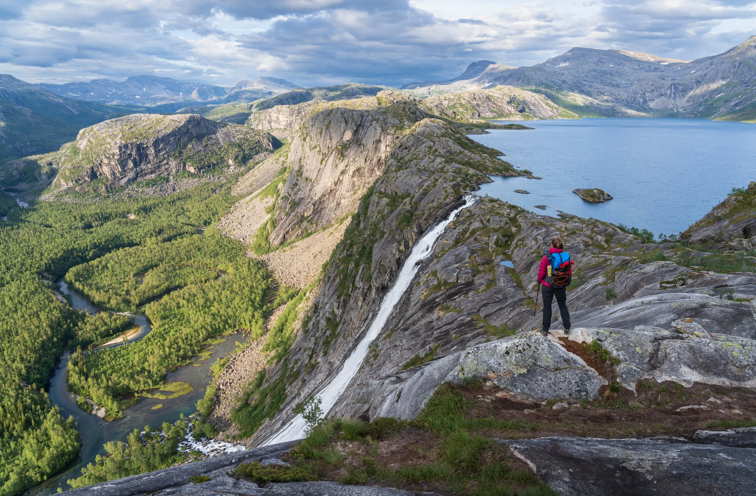
The Rago circuit
For this trek, we need to carry the tent, sleeping bags, and food in our backpacks.
From Lakshola, we followed a marked trail along the crystal-clear waters of Storskogelva. A suspension bridge allowed us to cross the river and head into the wilds of Rago. We climbed up Nordskaret on a steep path, but the views from the top made the effort worthwhile. The terrain was rough and often wet as we walked deeper into the park. Wooden planks helped us cross the wettest sections of the trail. After about 9 kilometers, we reached Storskogvatnet, a fantastic place to spend the night in a tent or in a small, unguarded shelter (only if there's space).
On the second day, we continued towards Sølvskrvatnan and along Litlverivatnet through a more mountainous landscape. Above the Litlverivassforsen waterfall, we crossed one of Norway's most beautiful (due to its location) suspension bridges. The best view of Rago is from Grisryggen, a couple of hundred meters from the suspension bridge. After another 5 kilometers of walking, we reached Litjsand, and finally, two kilometers further on, back to Lakshola.
In the afternoon, we continued by car to Bodo where we spent the night.
Day 15 · BODO - flight back home.
Return flight (not included)
Important information
Accommodation
In Bodø and Evenes: hostels, standard double rooms (triple or quadruple rooms available in exceptional cases).
Elsewhere: most nights spent camping and some in shared accommodations (rorbu, sjøhus, hytte or private homes, double rooms, sometimes triple or quadruple rooms).
Meals
Not included in the price. Restaurants are expensive in Norway, and we will often be cooking for ourselves. The help of other participants in preparing meals is very important. We will pool our money for these homemade meals. In restaurants, each participant will pay for their own food and drinks.
Personal equipment
Travel bag. Hiking boots with a waterproof Gore-Tex membrane. Backpack with a 50/60 liter capacity (we will sometimes sleep outdoors and will need to carry a sleeping bag, tent, and food). Appropriate hiking clothing (warm clothing, down jacket or similar, and also a waterproof Gore-Tex jacket and pants). Warm sleeping bag (for nighttime temperatures in a tent +5ºC - can be rented from Exploramunt), sleeping bag liner (to be used in hostels), fleece gloves, wool hat, sunglasses, hiking poles. External battery (power bank) to recharge mobile phone and camera batteries during camping trips.
Transport
By car or van driven by the guide. Ferry.
Difficulty level 3/5
3 to 6 hours of hiking per day. Steep and sometimes slippery trails. Some easy, steep passages (the guide will help you through).
Group size
Maximum 5 people.
Healthcare and insurance
Although Norway is not part of the European Union, the European Health Insurance Card is valid in the country and allows you to receive emergency medical care under the same conditions as Norwegian residents. Keep in mind that Norway has a co-payment system,so you will have to pay a portion of the cost of consultations and medications.
Private insurance is not included in the price, but we recommend purchasing it. Exploramunt does not offer insurance, but you will find everything you need on our website (we can also advise you). We recommend having insurance that covers accidents and mountain rescues, as well as helicopter transport. Some federation insurance policies cover this, and you should also have (it can be the same or a different policy) travel and cancellation insurance. Some credit cards, such as Visa Gold, include travel insurance if you pay for the trip with them. In our case, you can pay for the trip by card through a link from our bank (you can request this payment method when registering).
Luggage
To fit everything in the van, we can take a maximum of one medium-sized suitcase (approximately 60L maximum) per person. We advise you to wear your full hiking gear for the flight. This way, in case your luggage is lost, you can still enjoy your first hikes without any problems.
Guide
Prices and conditions
Price: from €2,250
Included in the price: Accommodation as specified in the "accommodation" section, from day 1 to day 12. Transfers in a van driven by the guide. Ferry from Bodo to [location missing]. Guiding by mountain guide David Casajuana. VAT.
Not included in the price: Flights. Breakfast, lunch, and dinner. Entrance fees to museums or other attractions, extra activities (as indicated in the program). Drinks. Insurance. Gratuities.
Note on international flights: SAS, Norwegian…contact us and we'll help you find the best flight. Currently, round-trip flights are under €400.
Payment terms: Given the imminent departure date, the trip must be paid in full upon registration. We advise you to purchase cancellation insurance at the time of registration.
Price of the 3-day extension: €385
More information via WhatsApp: +34 670 671 704