Nepal, ascent of Pachermo peak (6,272m) and Gokyo and Rolwaling trek
Ascent of Pachermo Peak (6,272 m) in the Everest region. To acclimatize, we'll undertake the magnificent trek through the Gokyo Lakes, ascending Gokyo Ri (5,280 m) from where we'll enjoy views of four 8,000-meter peaks (Everest, Lhotse, Cho Oyu, and Makalu). We'll then continue across the Ranjo Pass at 5,363 m. Up to this point, we'll be staying in lodges (local houses converted into hostels), but for the next few days and until the end of the trek, we'll pitch our own tents each night. Finally, well-acclimated from the previous days, we'll ascend Pachermo Peak using fixed ropes and mountaineering equipment. We'll descend through the quiet but beautiful Rolwaling Valley. This trip can also be done without the ascent of Pachermo Peak.


20 days from €5,135 (all flights included)
DEPARTURE CONFIRMED! From November 20th to December 9th
Technical difficulty (Mountaineering): PD. 45º slopes.
Experience in the use of crampons and ice axes is recommended.
Physical difficulty: High. Between 4 and 8 hours of walking per day during the trek and
Between 9 and 10 hours for summit day. A good level of fitness is required
physical fitness and regular practice of an endurance sport.
This trip can be done on the same dates without climbing Pachermo peak
doing the entire trek.
The pluses of this program
The ascent of Pachermo peak at 6,272m
A trek approaching and descending through the valley of the lakes
from Gokyo and through the sparsely populated Rolwaling.
Views of 4 peaks over 8,000 meters: Everest, Lhotse, Makalu
and Cho Oyu
A route that crosses two mountain passes over 5,000 meters high
and the ascent of Gokyo Ri allowing for good acclimatization.
A team of experienced guides.
Presence of healthcare personnel specialized in mountain and high altitude.
Are you a family or group and want to privatize the trip by choosing
the dates?
PROGRAM
Day 0 (November 20) · Overnight flight Spain - Kathmandu
Flight included. Europe-Kathmandu with 1 stopover.
Day 1 · KTM flight to Lukla (2850 m), first steps to Phakding (2640 m)
In approximately 40 minutes of flight (flight subject to weather and operational conditions) we arrive at Lukla at 2850 m. Here we start walking to Phakding (2640 m) via Tadokoshi.
3.5 hours of walking. Elevation gain/loss: +100 m/-300 m. Overnight stay in a lodge
Day 2 · Phakding (2630 m) - Jorsale (2800 m) - Namche Bazaar (3440 m)
We ascend the Dudh Khosi (the "Milk River" in Nepali) through forests, terraced fields, and small villages. We cross several suspension bridges to reach the village of Jorsale (2800 m) and, after lunch, continue our steady climb along a trail to the Sherpa capital at 3440 m. If we're lucky and the day is clear, we'll catch a glimpse of Everest during the second part of the ascent. The day ends in Namche Bazaar, accessible only on foot or by helicopter: we're in Sherpa country!
6 hours of hiking. Elevation gain/loss: +1000 m/-350 m. Overnight stay in a lodge
Day 3 · Namche Bazar (3,440m) - Khumjung (3790m)
We ascend through a small forest and admire the towering peaks of the Khumbu region (Everest, Lhotse, Ama Dablam). We arrive at the villages of Kunde and Khumjung, where we will have the opportunity to visit the Hillary Institute and Kunde Hospital, both built at Hillary's initiative. This stage is short and relatively flat, designed to allow for better acclimatization to the altitude.
3 hours of walking. Elevation gain/loss: +420 m/-20 m. Accommodation in a lodge
Day 4 · Khumjung - Dole (4040 m)
The trail continues to Mong La, a pass perched on Mount Khumbila. This offers the best viewpoint of many of the beautiful snow-capped mountains surrounding us and the valley below. There is a chorten in the center of the village, and the trail continues through the forest, crossing bridges and the river until reaching Dole.
5 hours of hiking. Elevation gain/loss: +880 m/-630 m. Overnight in a lodge
Day 5 · Dole - Machermo (4400 m)
A gradual ascent through the forest alongside the river. The trail passes through several villages before opening onto the vast alpine pastures of the Himalayas. We climb slowly to continue acclimatizing.
4-hour hike. Elevation gain/loss: +450 m/-100 m. Overnight stay in a lodge
Day 6 · Machhermo-Gokyo (4750 m)
We continued on to the Gokyo Lakes, with their spectacular blue waters nestled in a stunning mountain setting. We stopped at the second lake and settled into one of the lodges for two nights.
5 hours of hiking. Elevation gain/loss: +420 m/-150 m. Overnight stay in a lodge
Day 7 Gokyo - Gokyo Ri (5340 m) - Gokyo
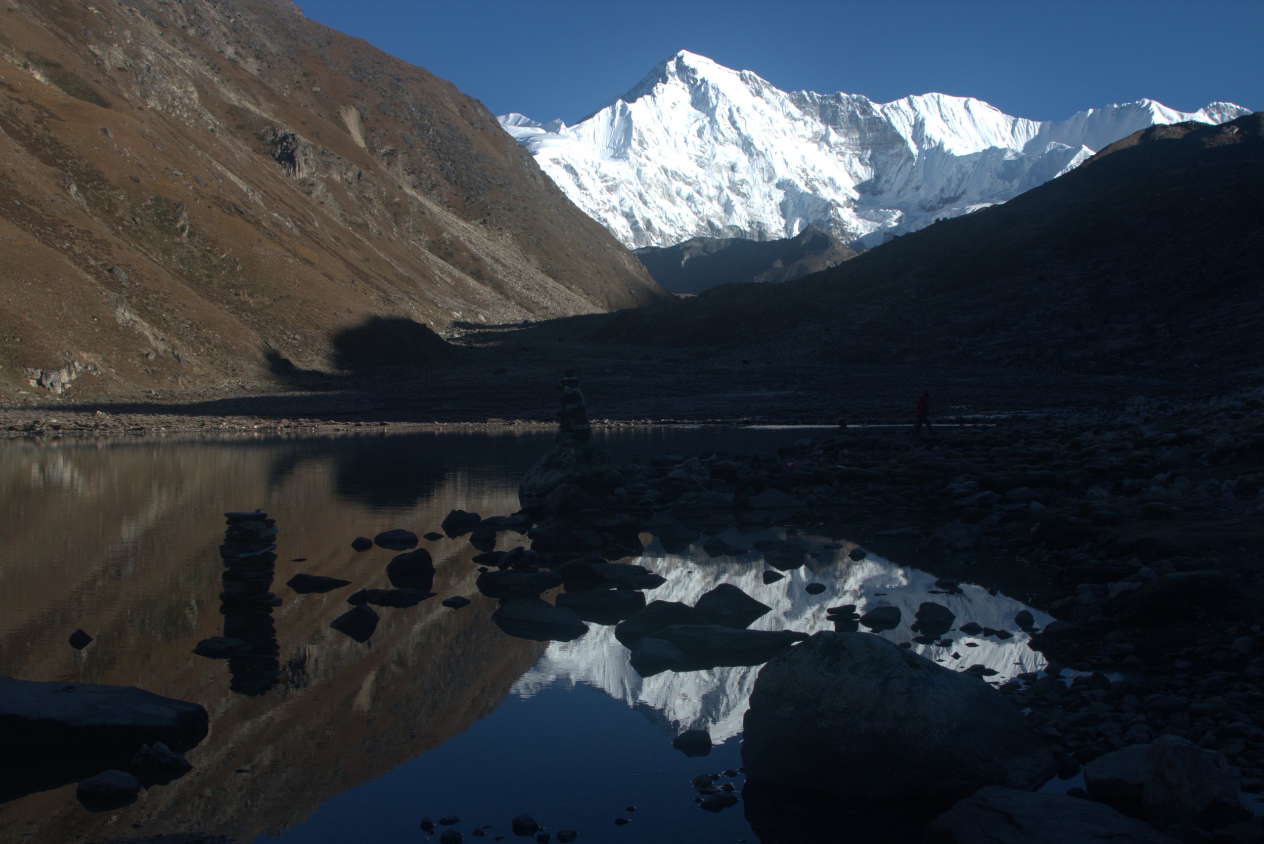
Ascent to Gokyo Ri to watch the sunrise over the Everest region mountains (Everest, Cho Yu, Makalu, and Lhotse). We descend back to Gokyo for a second night at the lake lodge.
4.5 hours of walking. Elevation gain/loss: +590 m/-590 m. Overnight stay in a lodge
Day 8 · Gokyo - Renjo La Pass (5360 m) - Lungden (4380 m)
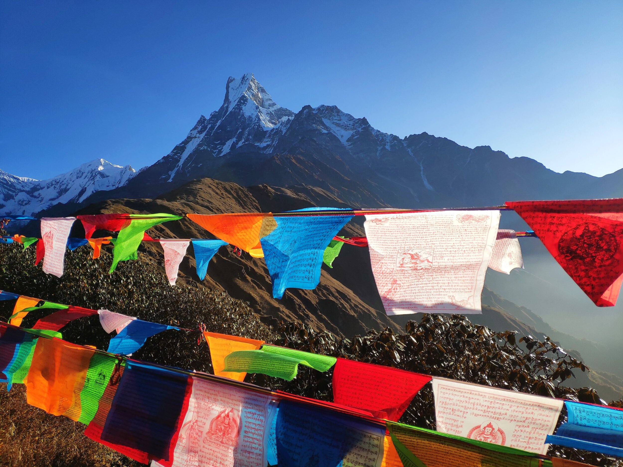
We slowly ascend towards the Renjo La pass at 5,360 meters while enjoying beautiful views of Lake Gokyo. Prayer flags and red-billed choughs welcome us at the pass, where we enjoy one of the most beautiful views, if not the most beautiful, of the trip! From Cho Oyu to Makalu, passing by Everest and Lhotse, to name just the eight-thousanders! Then we descend to the Thame Valley, from where, for the first time, we catch sight of our objective: Pachermo Peak, which, at 6,272 meters, gleams snow-capped at the end of a valley. To end this beautiful stage, we descend to the Lungden Lodge, where we spend the night.
5 hours of hiking. Elevation gain/loss: +680 m/-1080 m. Overnight stay in a lodge
Day 9 Lungden-Thame (3820 m)
We hike along the trail towards the Nangpa La Pass, traversing breathtaking landscapes along an ancient trade route that once connected Sherpa Country with Tibet. This is an easy stage and the last one where we'll stay in a lodge, as we'll be sleeping in tents from tomorrow onwards. Upon arriving in Thame, we'll have time to stroll around and discover the magnificent monastery that overlooks the village.
4-hour hike. Elevation gain/loss: +100 m/-600 m. Accommodation in a lodge
Day 10 Thame - Parchemuche Tsho Camp (4780 m)
After the first stage of the trek, we slept in lodges and gradually acclimatized to the altitude. Today we begin the second stage, where we'll camp with our local team joining us (a cook, a mountain guide, and some additional porters). We leave the familiar trails behind and venture into a slightly more rugged environment. We ascend through the valley and approach the glaciers that guard the surrounding peaks. For this first night under the tent, we'll camp at Parchemuche Tsho.
7 hours of walking. Elevation gain/loss: +1000 m/-80 m. Overnight in a tent.
Day 11 · Parchemuche Tsho Camp - Tashi Laptsa Camp (5660 m)
We continued climbing towards Tashi Laptsa Pass, but stopped a little lower down to camp comfortably before tomorrow's ascent. This afternoon we checked our gear, hydrated well, and went to bed early, as we had to get up very early tomorrow and needed to recover our strength.
6 hours of walking. Elevation gain/loss: +850 m/-0 m. Overnight in a tent.
Day 12 · Tashi Laptsa Camp - ASCENT TO PACHERMO PEAK (6272 m) - Dugog Axe (5200 m)
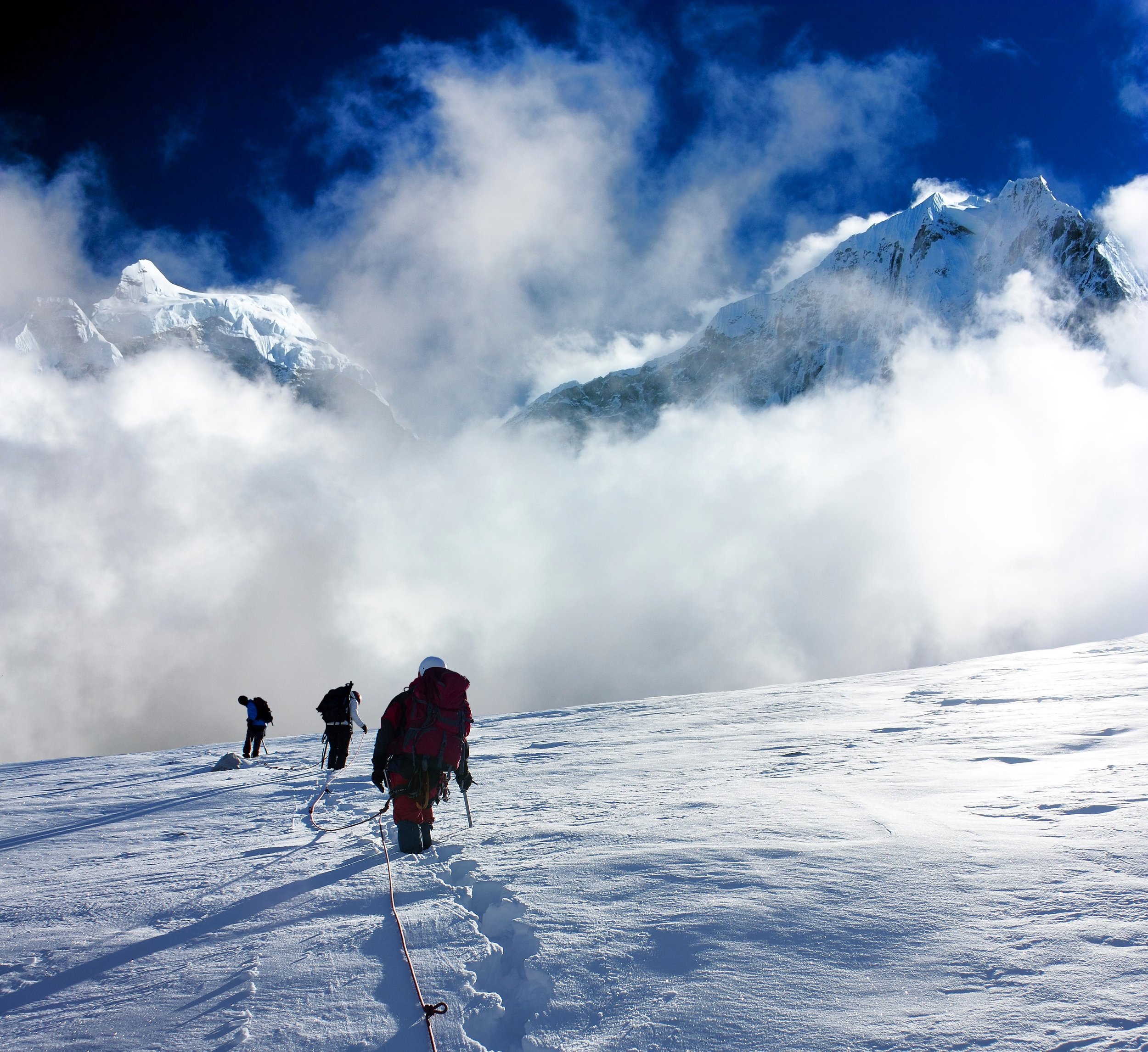
We woke up in the middle of the night and set off for the pass, for which we needed our mountaineering equipment. Although the cold was intense at dawn, the extraordinary spectacle of the surrounding landscape more than compensated for it! Once at the pass, we began the ascent up the south ridge, a gentle slope that eventually steepened. For the steeper sections near the summit, our guides would install fixed ropes to ensure our safety during the climb. At the summit, an exceptional panorama unfolded before us: the Khumbu region on one side, the Rolwaling Valley on the other, and a multitude of peaks. We began the descent by returning to the pass and continued down the Rolwaling slope to the Axe Dugog camp, located on a rocky spur. Here, to secure our progress, we would install another 100 to 200 meters of fixed rope. A long day, but truly breathtaking.
Between 9 and 10 hours of walking. Elevation gain/loss: +640 m/-1000 m. Overnight in a tent.
Day 13 · Dugog Axe - Na (4180 m)
We descended towards the glacier, which in this area is covered by the rocks of the moraine. The route isn't always easy to find, as the glacier advances and shifts every year, altering the itinerary. After several hours, we found a slightly easier path, but it was still a long day to reach the small village of Na. After a few days in the mineral world of the high mountains, it's nice to reconnect with some human life, even if the village is very modest. Na, once a simple kharka with a few temporary shepherds' shelters, has gradually transformed into a village inhabited for much of the year. The meadows are full of edelweiss, and the mountain scenery surrounding this valley is truly beautiful: Chekigo, Bamongo, Kang Nachugo, Tsoboche... all 6,000-meter peaks!
8 hours of hiking. Elevation gain/loss: +200 m/-1000 m. Overnight stay in a tent
Day 14 · Na-Dongang (2830 m)
We continued our descent along the Rolwaling Kola River and passed through another village: Beding, a remote spot at 3,600 meters, with a few houses, shops, and a gompa (monastery). Autumn is a special time in this high Rolwaling Valley: its inhabitants have a single goal: to bring in as much firewood as possible at all costs to keep warm throughout the winter. To this end, a steady stream of porters travels from dawn till dusk along the path that connects the village, on the right bank, with the forest on the other side of the river. An improvised footbridge of logs has been built over the river to avoid having to go around it using the bridge further downstream. Further on, we found ourselves back among the vegetation, and the path was better marked. We thus arrived at our campsite.
5 hours of hiking. Elevation gain/loss: +150 m/-1500 m. Overnight in a tent
Day 15 · Dongang - Simi Gaon (2050 m)
We reached the left bank of the Rolwaling Khola. The trail descends into a beautiful pine forest and we arrived at the Sherpa village of Simi, with its terraced hillside.
5 hours of hiking. Elevation gain/loss: +1270 m/-260 m. Overnight in a tent
Day 16 · By car: Simi Gaon-Kathmandu
Approximately 9 hours by road. Hotel accommodation
Day 17 · Kathmandu
Safety day off that we could use in case of bad weather during the trek or summit day.
hotel accommodation
Day 18 · Return flight
Return flight departure day. Transfer to the airport and return. Almost all flights depart at midday or in the afternoon and arrive the following day.
Day 19: Arrival
Important information
Accommodation
Standard hotel in Kathmandu (2 nights), in a lodge during the first part of the trek and in a tent during the second part of the trek and the ascent.
Meals
The lodges provide meals and during the second part of the trek a cook accompanies us and cooks.
Personal equipment
Personal equipment will be limited by the weight that can be transported on the flight to Lukla (15 kg) and also by the weight that the porters can carry (about 12 or 13 kg of equipment per client). If you wish to bring more equipment, you will have to pay for excess baggage on the flight and also hire an extra porter during the trek.
Travel bag. 40L backpack. Trekking boots. Mountaineering boots (expedition boots, preferably with inner booties). Crampons with anti-balling plates. Lightweight ice axe. Sleeping bag (comfort temperature -25°C). Appropriate clothing for high-altitude conditions. Personal first-aid kit. You will receive a complete list of personal equipment tailored to this trip upon registration. Sleeping bags can be rented from Exploramunt. All equipment can also be rented in Kathmandu, but we strongly advise that you own your own boots and test them in the field before the trip.
Transport
International flights with scheduled airlines (Turkish Airlines, Qatar Airways) always involve a layover. The flight to Lukla is operated by a local airline. Ground transportation is available by taxi, van, and minibus.
DOMESTIC FLIGHT WARNING IN NEPAL: Between Kathmandu and Lukla, we use local flights for your transfers. Please be advised that this transfer is only available with a local Nepali airline. All local Nepali airlines are on the European Union's blacklist of airlines banned from operating in the EU, meaning the EU considers them "unsafe." Other civil aviation authorities worldwide have not issued this opinion. We exclusively use the following three airlines: Tara Air, Buddha Air, and Yeti Airlines, as they have recently been audited by an independent organization that deemed their safety standards acceptable.
By registering for this trip, you agree to accept and assume responsibility for flying to Lukla with a local airline.
Furthermore, we would like to inform you that major construction work at Kathmandu Airport is preventing domestic flights from departing from the capital. Due to increased air traffic congestion and the growing number of flights to Lukla, it has been agreed to operate all these flights from Ramechhap Airport (approximately a 4-hour drive from Kathmandu).
Physical and technical difficulty
PHYSICAL LEVEL: HIGH
This program is aimed at participants in good physical condition, especially with endurance, and with good mental strength to cope with unforeseen difficulties.
This is a 15-day route, with stages averaging 6 to 8 hours of hiking per day. It includes two mountain passes and a viewpoint (Goko Ri) between 5,000 and 5,800 meters. Ascending Pachermo requires the use of crampons, ice axes, Jumars, and descenders. Prior PD/AD level mountaineering experience in the Pyrenees or Alps is recommended to feel comfortable on 40°/45° snow slopes
TECHNICAL LEVEL OF MOUNTAINEERING: SLIGHTLY DIFFICULT (PD)
Pachermo Peak is not a difficult summit, but it does require the use of mountaineering equipment (crampons, harness, ice axe, ropes, etc.) and may present some minor difficulties, such as steeper sections of up to 45 degrees. Therefore, it is aimed at beginners with basic mountaineering experience who have already completed some ascents of this level or slightly lower. This technical rating applies to normal weather conditions, but the difficulty can increase in adverse conditions such as fresh snow or wind. Similarly, altitude is also an important factor to consider.
We recommend that those with no prior experience take a short basic mountaineering course in the Pyrenees or Alps. You can contact us to register for our next course, which will be held in the Écrins region (French Alps) in July.
The world of high peaks, acclimatization and altitude sickness
Altitude, starting at 3,000 meters for some people, can be the biggest challenge when climbing a peak or even trekking. The itinerary we propose is designed to allow time for acclimatization before the summit. Even so, ibuprofen and/or acetoacetamide can aid in acclimatization and reduce some of the associated symptoms.
On this trek and climb, we will have the assistance and advice of medical personnel specializing in high-altitude medicine. We will also carry oxygen to address any potential problems.
Health and prevention, vaccines
There are no mandatory vaccinations for entry into the country (unless the traveler has recently been in a country with yellow fever), but it is advisable to be up-to-date on routine vaccinations. It is also advisable to consult your doctor before traveling, especially if you have any chronic illness.
Travel documents and formalities
Passport valid for six months after the return date and with at least two blank pages. Nepal entry visa ($50) to be obtained from the official website http://www.nepalimmigration.gov.np/
It is recommended to consult the website of the Ministry of Foreign Affairs: https://www.exteriores.gob.es/es/ServiciosAlCiudadano/Paginas/Detalle-recomendaciones-de-viaje.aspx?trc=Nepal
Climate and meteorology
In Nepal, the dry season runs from October to May and the rainy season (monsoon) runs from June to September.
The autumn season, which runs from October to early December, is characterized by clear skies. At night, at altitudes near 6,000 meters, temperatures can reach -20°C and occasionally even lower.
Group size
Maximum 12 people.
What do we carry in our backpack during the day
During activities and hikes, we only carry a backpack with our gear for the day and our picnic lunch. The rest (our sleeping bag) is carried by the porters.
Insurance
Insurance is not included in the price but is mandatory for the trip. Exploramunt does not offer insurance, but you will find everything you need on the website (we can also advise you). It is recommended to have insurance that covers accidents and mountain rescues—make sure it covers the country, the altitude (in this case, over 6,000m), and helicopter rescue. Some federation insurance policies cover this. You should also have (it can be the same or a different policy) travel and cancellation insurance. Some credit cards, such as Visa Gold, include travel insurance if you pay for the trip with them. In our case, you can pay for the trip by card through a secure bank link (you can request this payment method when registering).
Tips
At the end of a trip, it's customary to show appreciation by tipping the team: guides, drivers, cooks, porters, or muleteers. The amount of the tip depends on your satisfaction, the size of your group, and the size of the local team. These guidelines are not mandatory and are not considered a salary, but they are important for the local teams. As a general rule, you can estimate an expense of €50 per week per participant for hostel-based excursions and €70-80 per week per participant for tented excursions. However, this can increase on some treks or expeditions where the local team is very large (a classic example is Kilimanjaro, where a tip of €150-200 per client is typical for a week-long climb).
Guides and support
Exploramunt guide (David Casajuana), local trekking and high mountain guides, porters, cook (from day 10 in Thame).
Prices and conditions
Price: from €5,135 per person (flights included*)
Single room supplement in Kathmandu: €150 (single rooms cannot be guaranteed in lodges)
Included in the price: Round-trip international flights from E. Kathmandu-Lukla flight. Ground transfers in Nepal as per the program. Camping equipment (except sleeping bag). Climbing equipment (fixed ropes). Full board accommodation every day except lunch and dinner in Kathmandu (accommodation is in a double room in Kathmandu, in a shared room in the lodges, and in a two-person tent from day 10 to 16). Local guide and equipment as described in the program and in Important Information. Entrance to Everest National Park. Pachermo climbing permit. VAT.
Not included in the price: Showers, Wi-Fi, and battery charging (if available, at an additional cost, approximately €2-5). Excess baggage fees on domestic or international flights. Lunches and dinners in Kathmandu. Nepal entry visa ($50). Personal equipment (sleeping bag, harness, rappel device, descender, etc.). Gratuities. Drinks. Insurance. Entrance fees to sites and museums in Kathmandu. Any services not explicitly described in the program or important information.
*The price will be reviewed for each registration to adjust for the international flight cost. If it exceeds the budgeted €855 per person, the corresponding increase will be applied to the final price.
Terms of payment
50% of the price must be paid upon registration, and the remainder no later than one month before departure. Payment can be made by bank transfer or credit/debit card (please request this option at the time of registration). Some cards may be subject to a fee. Please note that in case of cancellation, a portion of the price is non-refundable (flights and some local services), so we advise you to purchase cancellation insurance at the time of registration.